As part of my work the SETI Institute and for the Artemis Geospatial Data Team, I am developing advanced software pipelines and tooling to produce 1 meter per pixel digital terrain/elevation models (a.k.a. DTM/DEM) using the Ames Stereo Pipeline Shape-from-Shading (SfS) capability for Artemis III landing sites at the South Pole of the Moon. This software consists of Python and SQL via DuckDB for rapid spatial joins and bundle adjust statistic analysis across thousands of LRO NAC images as well as bash pipelines to orchistrate efficient processing on the NASA Ames High-End Computing Capability (HECC) system. The first location I am producing models for is the Mons Mouton Plateau, the largest of the 2024 Artemis III Candidate Landing Regions. We anticipate release of these products in fall 2025.
Mons Mouton SFS Reconstruction Hillshade and Maximally Illuminated Map
Artemis III Landing Site Digital Terrain Modeling via Shape-from-Shading (SfS)
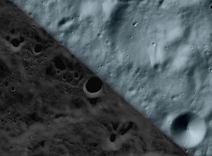 Mons Mouton SFS Reconstruction Hillshade and Maximally Illuminated Map
Artemis III Landing Site Digital Terrain Modeling via Shape-from-Shading (SfS)
)
Andrew M. Annex
Senior Science Systems Engineer
My research interests include the applications of deep learning to planetary geology.