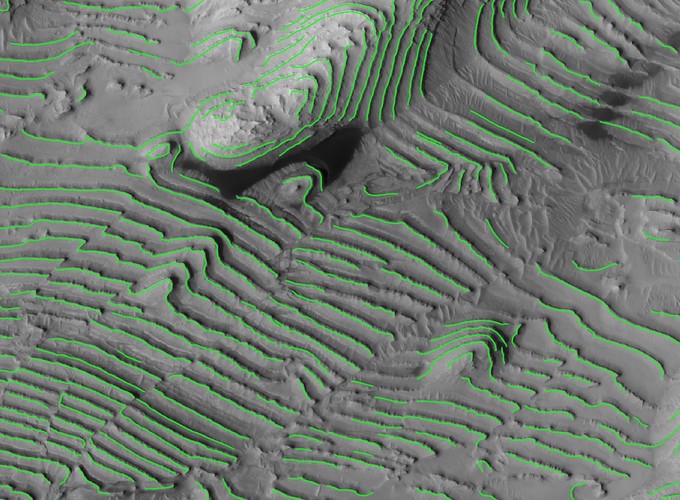
For my Ph.D. research, as I explain further in my Arabia Terra project, I am mapping traces of the layered deposits in Arabia Terra in order to measure how thick each layer is and to investigate their structure from their geometry. I am mapping the layers in HiRISE images that I am also producing Digital Elevation Models (DEMs) which cover relatively large areas of Mars at 0.25 cm per pixel resolution. Mapping the deposits by hand is tedious busy work, and is distracting from the science I want to accomplish. To accelerate the mapping of these layered deposits, in 2018 I developed a training data set from layers I had already mapped and trained a U-Net architecture Convolutional Neural Network (CNN) to automate the process. Specifically, the CNN was trained on 1 meter per pixel normalized HiRISE images, so it would not rely on the elevation models to map my layers, and was provided many true negative examples of other similar surface features such as linear dunes which were not desireable to map. Traditional computer vision techniques need to be more deeply investigated, but as there is a large number of criteria that I use when mapping the layers that would be difficult to quantify, using a neural network allows me to quantify my expert knowledge implicitly from the training data. I presented an abstract and talk about this work at the 2018 NASA Goddard AI Workshop.
)
Andrew M. Annex
Senior Software Engineer
My research interests include the applications of deep learning to planetary geology.